|
CONSULTING
SERVICES
Modern consulting
expertise for Ni-Cu, PGE, Cr and Fe-Ti-V oxide deposits now goes
far beyond the conventional site visit with follow-up recommendations
as was the case not too many years ago. However, unless the consultant
and his team are very well versed and experienced in utilizing and
interpreting geophysics, geochemistry, remote sensing, drill hole
targeting techniques and software the likelihood of exploration
success is rather bleak in this modern era of exploration in areas
of limited to no rock exposure (Ring of Fire, Ontario)
or exploration for deep targets (Thompson Nickel Belt, Sudbury,
Raglan, etc.). Through its years of experience and contacts,
NiPtx Inc. brings together a team of world-class professionals
and contractors to get the job done successfully, and in the most
cost effective manner. Below is a brief list of some of the added
value products NiPtx Inc. brings to its clients projects:
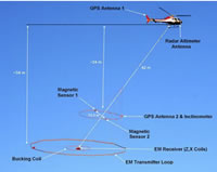
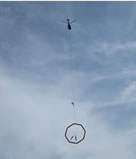
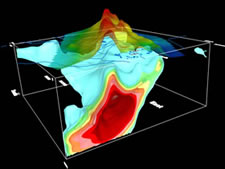
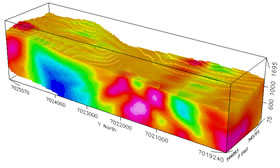
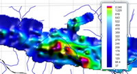
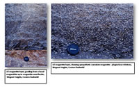
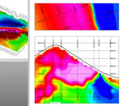
Geophysics
- Recommend
the most effective type of ground and airborne geophysical surveys
for the project.
- Interpretation
of existing geophysical data.
- Interface
with world-class geophysical associates.
- Acquire geophysical
inversions from existing or new geophysical data.
- Integrate
geophysical and geological data.

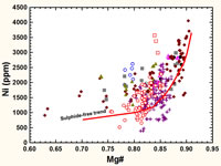
Geochemistry
- Lithogeochemistry
-
Analyse
whole rock and 4-acid ICP data for metallogenic vectors
in order to evaluate the prospectivity of the property.
- Establish
a lithological classification for rocks and core based on
whole rock or 4-acid ICP analytical data in order to remove
the rock type inconsistencies introduced by loggers interpretations.
- Chemostratigraphic
analyses to disclose hidden or cryptic geochemical/metal trends
and lateral lithological trends, and telescoping mineralization
from disseminated to massive.
- Applied geochemistry
- Design
and manage soil and stream geochemical surveys.
- Establish
and oversee strick QA-QC protocols.
- Analyse
and interpret survey data.
- Analytical
protocols
- Suggest
the best and most cost effective analytical packages for the
clients' needs.
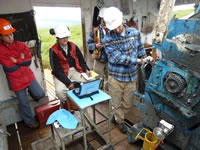
- Portable XRF (PXRF) Surveys
- Training field crews for in-situ portable XRF analyses in Ni-Cu-PGE exploration programs.
- Establishing QA-C protocols and standards for Ni-Cu-PGE exploration programs.
- Design regional PXRF reconnassiance surveys for Ni-Cu-PGE exploration.

- Design detailed PXRF surveys for Ni-Cu-PGE exploration.
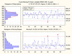
QA-QC
- Recommend
appropriate certified reference material (standards, blanks, etc.)
for the project.
- Establish
QA-QC protocol with analytical laboratory and field/drill core
logging geologists.
- Rigorous
"industrial quality" QA-QC analyses of data during and
after program.
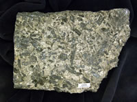
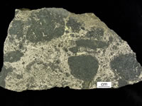
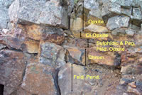
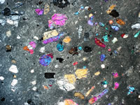
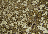
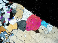
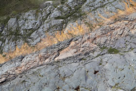
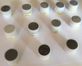
Petrological
Investigations
- Petrographic
Studies.
- Ore Textural
studies and mineralogical constituents.
- Petrological
classifications: thoeleiitic, komatiitic, ferro-picritic, alkaline.
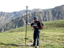
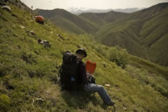
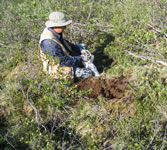
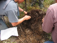
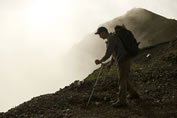
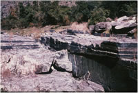
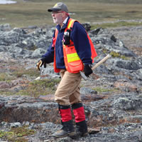
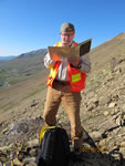
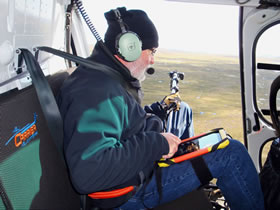
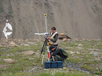
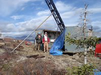
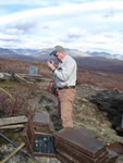
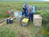
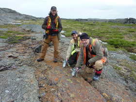
Site
Visits & Field Work
- Site visits
to the property to give on-site impressions and recommendations.
- Follow-up
field work and examinations required for "Due Diligence"
purposes.
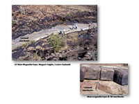
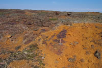
Mapping
- Detailed
examinations and mapping of mineralized areas.
- Production
of low-altitude, high resolution orthophoto base maps to aid mapping.
- Advice on
how to map mineralized zones and surrounds, and teach exploration
staff on mafic-ultramafic mapping techniques.
- On-site orthophoto
base map preparation of high resolution low altitude photographic
base maps for mapping (helicopter and Drone platforms).
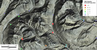
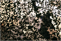
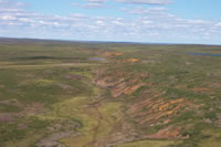
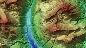
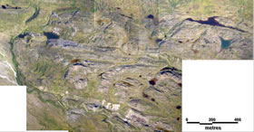
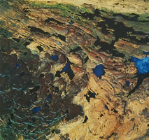
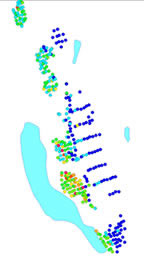
Remote
Sensing
- Production
of digital elevation models (DEM) based on availability of elevation
data: SRTM, LIDAR, ASTER, CDED (government digital elevation data),
vectorized topographic maps, geophysical survey DEM data, etc.
DEM's are invaluable products for interpreting the structure,
controls and lateral continuity of prospective properties.
- Production
of on-site low-altitude, high resolution orthophotography for
base maps and ground control point (GCP) GPS registration and
confirmation.
- Acquisition
and contracting of satellite imagery: Landsat, SPOT, IKONOS, QuickBird,
ASTER, WorldView2 & 3 and subsequent interpretation, re-processing,
resolution enhancement, and classifications.
- Layout and
manage LIDAR and orthophoto surveys.
- Acquire and
mosaic government airphoto and topographic data for project areas.
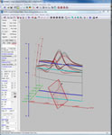
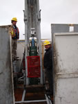
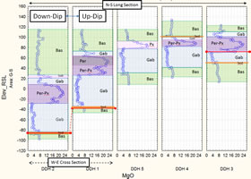
Drill
Hole Targeting
- Build drill
hole projects in Oasis Montaj, Target, GOCAD, Leapfrog.
- Integrate
geophysical plate modeling (Maxwell), inversions, BHEM survey
data into the prject for better control on targeting.
Compilations
- Acquire legacy
exploration data and convert from non-earth exploration grid to
a modern UTM based GIS project.
- Integrate
the compiled GIS geology, geophysical, geochemical and drill hole
data.
Program
Design & Layout
- Design all
aspects of the exploration program to meet clients' needs and
budget.
- Engage other
geological, geophysical and GIS associates to work with the client.
- Recommend
Phase II and Phase III of successful projects.
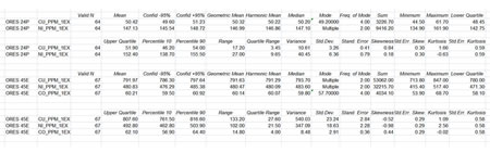
Geostatistics
- Conduct detailed
descriptive statistics, factor analysis, correlations, classifications,
etc. of clients' digital numeric data to establish if correlations
and/or factors exist that could be used as a tool in advancing
the exploration program.
Other
- Arrange for
resource evaluation.
- Arrange metallurgical
studies.
|